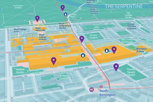
If you’re planning your trip to South Kensington, why not take a look at our brand new walking map, created in collaboration with Footways, where you can discover a range of wonderful routes to take a quiet stroll. Get off the tube a stop early and explore London’s home of arts, science and inspiration by foot. With over 22 cultural venues on our doorstep, the map showcases local points of interest, history and exciting destinations to explore on your travels.
Footways connects places with quiet and enjoyable streets, prompting people to choose walking as the most efficient, healthy and enjoyable option on A-to-B journeys. The South Kensington network has been designed to connect major venues and destinations with appealing, accessible and quiet streets, all while discovering the fascinating history of the area. Footways believes walkers arrive at destinations happier, healthier and with a greater connection and understanding of the city. By walking, the journey to South Kensington becomes part of your visit. Each walk on the map takes between 20 minutes and one hour to walk, featuring points of interest connected to the history of Exhibition Road and its museums, as well as mainline stations and shopping destinations.
Just over 35% of London residents aged 20+ achieve at least 20 minutes of active travel per day. This is a long way short of the Mayor’s Transport Strategy which aims for over 50% by 2030! Despite journey planning apps, such as Google Maps, prioritising speed over other factors such as enjoyment, safety, pollution, or carbon, very often the time savings by bus, or Tube are minimal. Research by Footways shows that most 15-minute walks in London don’t take much longer than a ride in a taxi or on the Tube. Plus, these apps often route visitors along boring, polluted and high-traffic streets in order to shave seconds off the journey. Instead, Footways prioritises low-traffic routes full of greenery, architectural interest, people and activity. The project works towards sustainable, integrated, healthy and enjoyable transport, forming a key part of South Kensington’s work to become a zero emissions and nature positive neighborhood.
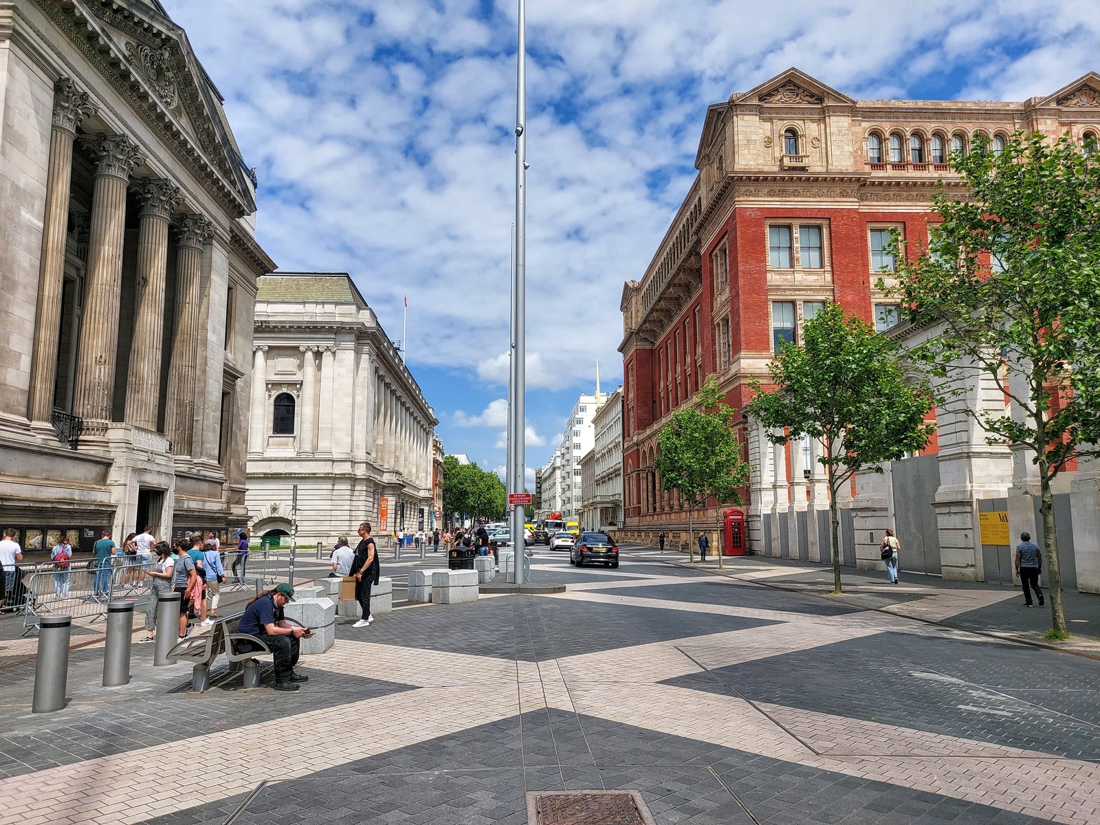
The map guides visitors along quieter routes that they may not usually take, discovering some unique features of the area as well as some interesting historical facts along the way. Did you know that during World War 2, a double bomb knocked out the windows of the V&A? And that the damage from the explosions can still be seen today? There is so much history to be uncovered as you follow the map around these fascinating streets.
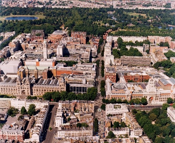
Why not start your trip at one of the mainline stations and journey through Kensington Gardens, making sure to take a glimpse at some of the famous historical landmarks of South Ken such as the birthplace of Queen Victoria, or the elegant floral planting at the Sunken Gardens? Or perhaps begin your trip at one of our astounding cultural venues on Exhibition Road, following the map past a whole world of art exhibitions, scientific discoveries and amazing creativity in the heart of London. The map connects the cultural venues between Exhibition Road and the Design Museum and is fantastic way to explore some of London's quieter roads, whilst discovering some of the extraordinary history of the area and getting active!